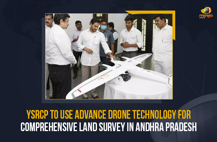
In order to enhance land surveillance, the Andhra Pradesh Government is planning to use advanced technology by deploying drones in the State.
On the 31st of March, Thursday, Mr. Y.S. Jagan Mohan Reddy, the Chief Minister of Andhra Pradesh (A.P.) held a review meeting on the ‘YSR Jagananna Saswatha Bhu Hakku – Bhu Raksha’ scheme and inspected the functioning of drones for land survey. Chaired by Mr. Y.S. Jagan Mohan Reddy, the meeting discussed problems in the Webland system of land records in a most transparent manner and other land survey issues. He asked the officials to prepare SOPs on procedures to be followed in this regard.
Furthermore, the Andhra Pradesh Chief Minister asked for land records to be prepared in such a way that they can’t be tampered with and are transparent. He said the survey should be conducted without delay once applied for sub-division. He also instructed the officials to set up Mobile Tribunals to solve land issues and said it would help resolve the issues locally.
Mr. Y.S. Jagan Mohan Reddy said, “AP should set an example in terms of Land Surveys and Records.”
Furthermore, in Andhra Pradesh, a total of 51 advanced drones would be operational for conducting land surveys by the 5th of April. The officials said, the drone survey was completed in 1,441 villages so far and are planning to complete more areas by monsoon (June.) The officials said they plan to complete the land survey and issue clear titles in 5,200 villages by the end of July 2023, 5,700 villages by the end of August 2023, and 6,460 villages by the end of September 2023.
They said the first phase of taking Orthorectified Radar Image (ORI) images in villages would be completed by November, the second phase by December, and the third phase by January 2023.
Mango News Link
Telegram: https://t.me/mangonewsofficial
Google Play Store: https://bit.ly/2R4cbgN
Apple / iOS Store: https://apple.co/2xEYFJ


